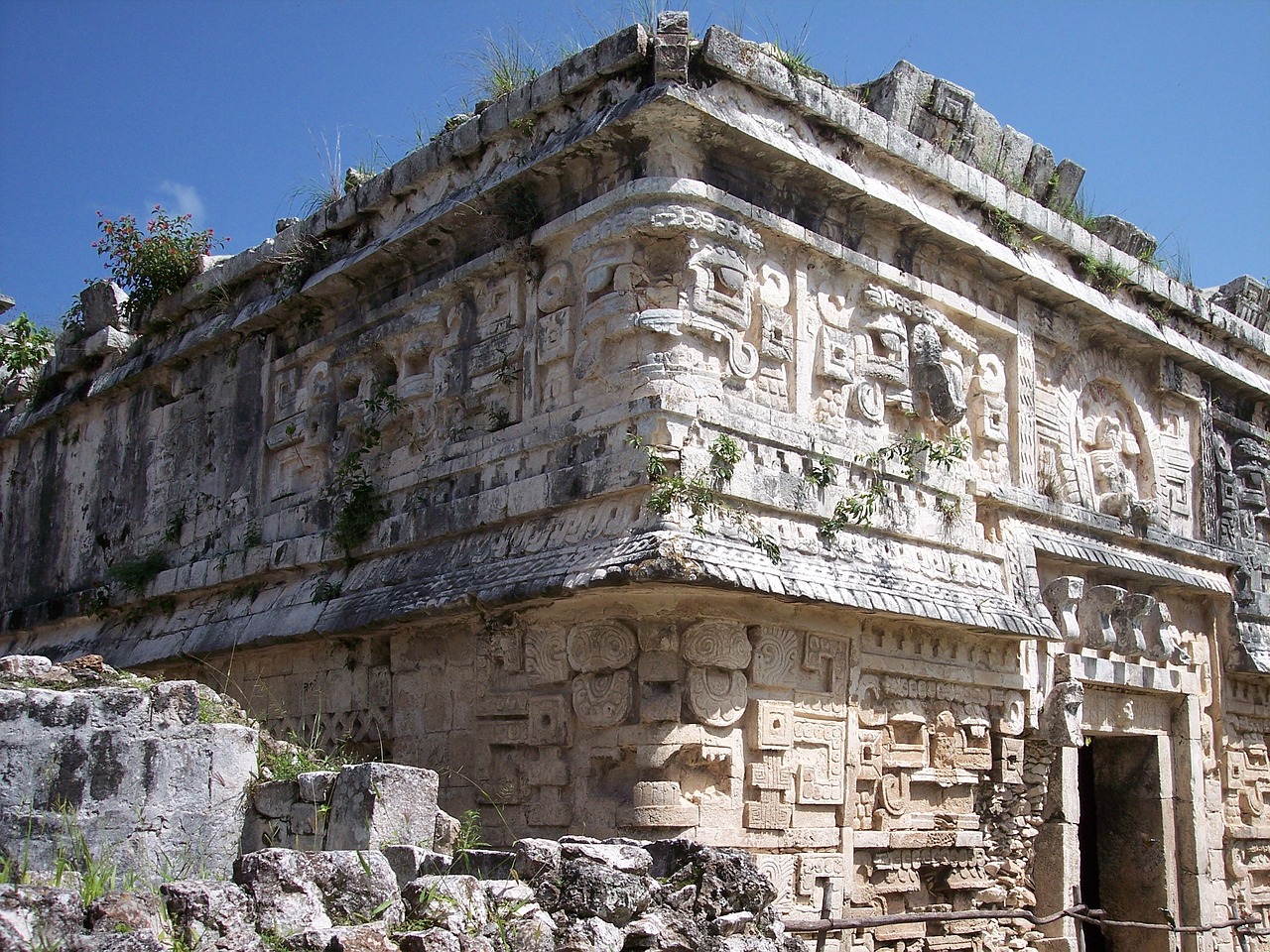
Advancements in Archaeological Survey Techniques
Advancements in Archaeological Survey Techniques have revolutionized the field of archaeology, allowing researchers to uncover hidden secrets of ancient civilizations with unprecedented precision and detail. The integration of cutting-edge technologies and innovative methods has opened up new possibilities for exploring historical artifacts and sites, providing valuable insights into the lives and cultures of our ancestors.
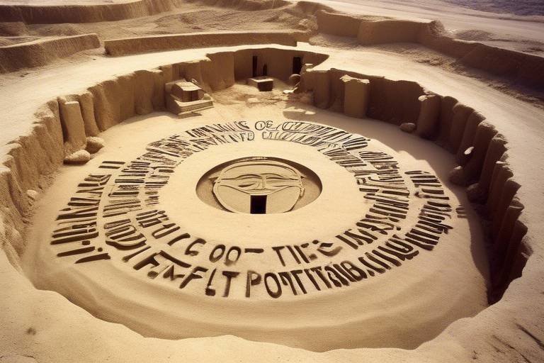
One of the most groundbreaking technologies in modern archaeology is Lidar Technology. By utilizing airborne laser scanning, researchers can create highly detailed 3D maps of archaeological sites, revealing hidden structures and features without disturbing the delicate environment. This non-invasive approach has transformed the way we study ancient civilizations, allowing for a more comprehensive understanding of their architectural achievements and urban layouts.
Ground-Penetrating Radar (GPR) has also played a crucial role in archaeological surveys. By sending radar pulses into the ground and analyzing the reflected signals, researchers can detect subsurface features and anomalies like buried structures and artifacts. This technology has significantly enhanced our ability to uncover hidden treasures without the need for extensive excavation, preserving the integrity of archaeological sites for future generations to explore.
Drone Surveys have become increasingly popular in archaeological research, thanks to their ability to capture high-resolution aerial images of sites. Equipped with advanced cameras and sensors, drones provide detailed maps and data that aid in the analysis and documentation of archaeological findings. This aerial perspective offers a unique view of historical landscapes, allowing researchers to identify patterns and connections that may not be visible from the ground.
Remote Sensing techniques, including satellite imagery and aerial photography, have revolutionized the way we monitor and study archaeological sites. By utilizing these tools, researchers can observe large areas from a distance, identifying changes in the landscape over time and pinpointing areas of interest for further investigation. This bird's-eye view offers a comprehensive understanding of the historical context of archaeological sites, shedding light on their significance and evolution.
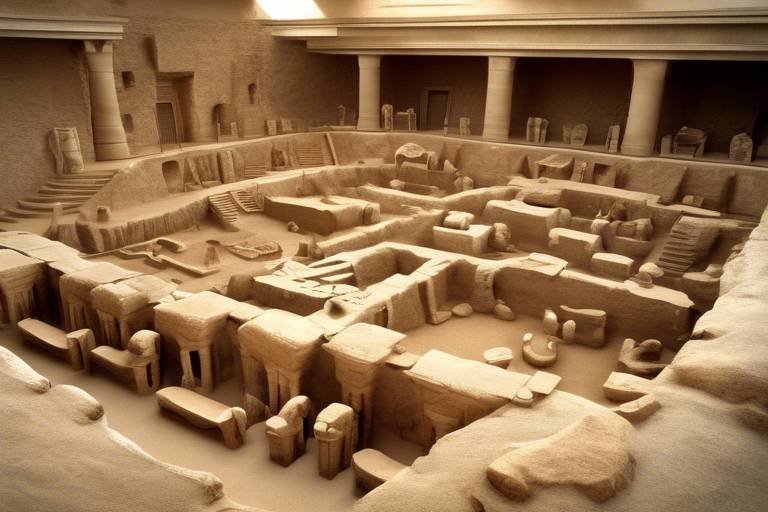
Geophysical Surveying methods, such as magnetometry and resistivity surveys, have proven invaluable in mapping subsurface features and anomalies. By employing these techniques, researchers can explore archaeological sites non-invasively, revealing hidden structures and artifacts beneath the surface. This approach minimizes the impact on fragile environments while maximizing the discovery potential, making it a vital tool in modern archaeological exploration.
Virtual Reality (VR) Reconstructions have transformed the way we interact with archaeological sites and artifacts. By creating immersive digital environments, researchers and the public can explore historical settings in a virtual space, gaining insights into the daily lives and practices of ancient civilizations. This innovative approach bridges the gap between the past and the present, offering a dynamic and engaging way to experience history firsthand.
Digital Data Analysis has become essential in processing and interpreting the vast amounts of data collected from archaeological surveys. By leveraging advanced software and algorithms, researchers can extract meaningful insights and patterns from complex datasets, revealing hidden connections and trends within the information. This analytical approach enhances our understanding of ancient cultures and societies, providing new perspectives on the past.
Underwater Archaeology Technologies have revolutionized the exploration of submerged sites and shipwrecks. Specialized tools like remotely operated vehicles (ROVs) and sonar systems enable researchers to investigate underwater environments with precision and accuracy, documenting artifacts and structures that have been preserved beneath the waves. This underwater perspective offers a unique glimpse into maritime history, uncovering stories of ancient seafaring and trade routes that have long been forgotten.
Lidar Technology
Lidar technology has revolutionized the field of archaeology by providing researchers with a powerful tool for mapping and analyzing archaeological sites in incredible detail. By employing airborne laser scanning technology, Lidar enables the creation of highly accurate 3D maps that reveal hidden structures and features without the need for physical excavation. This non-invasive approach allows archaeologists to uncover valuable insights about ancient civilizations while preserving the integrity of the sites.
Ground-Penetrating Radar (GPR)
Ground-Penetrating Radar (GPR) is a revolutionary technology that has transformed the field of archaeology by allowing researchers to detect subsurface features and anomalies with incredible precision and detail. By sending radar pulses into the ground and analyzing the reflected signals, GPR enables archaeologists to uncover buried structures, artifacts, and even entire hidden civilizations without the need for invasive excavation.
Imagine being able to see beneath the surface of the earth without ever lifting a shovel. That's the power of GPR technology. It provides archaeologists with a non-destructive way to explore archaeological sites, preserving the integrity of the environment while still uncovering valuable historical information.
One of the key advantages of GPR is its ability to penetrate different types of materials, allowing researchers to map subsurface features in various terrains, from deserts to dense forests. This versatility makes GPR an indispensable tool for archaeologists working in diverse geographic locations around the world.
Furthermore, GPR can reveal hidden structures that are invisible to the naked eye, such as ancient walls, foundations, and even complex networks of underground tunnels. By generating detailed images of the subsurface, GPR helps researchers piece together the puzzle of the past and gain a deeper understanding of ancient civilizations.
In addition to its archaeological applications, GPR technology is also used in other fields, such as geology, environmental science, and civil engineering. Its versatility and accuracy make it a valuable tool for a wide range of scientific disciplines, highlighting the impact and significance of this innovative technology.
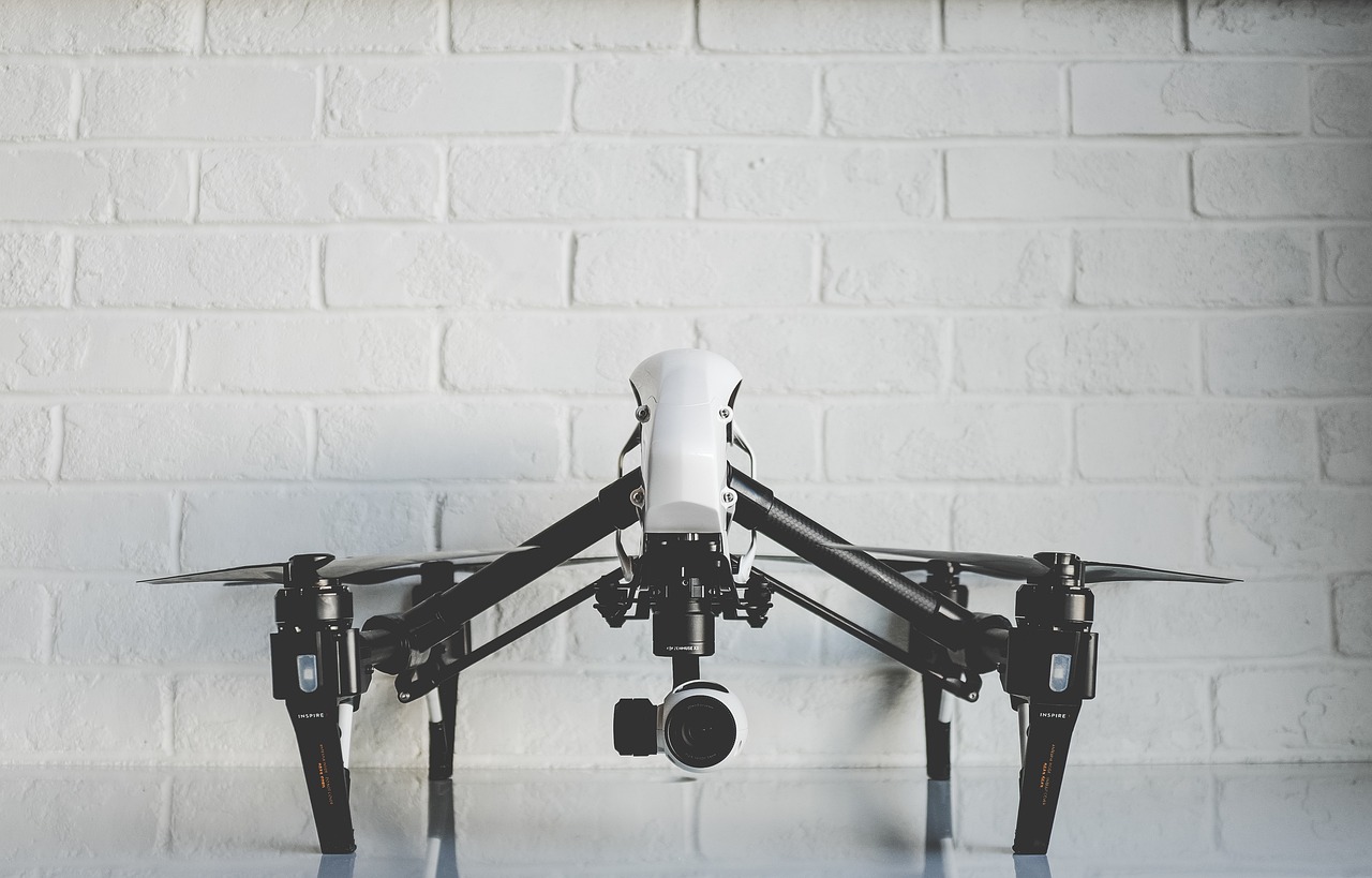
Drone Surveys
Drone surveys have revolutionized the field of archaeology by providing researchers with a bird's eye view of archaeological sites. These unmanned aerial vehicles, equipped with high-resolution cameras and sensors, capture detailed aerial images that offer a unique perspective of the landscape below. By flying drones over archaeological sites, researchers can create accurate maps and 3D models, allowing for a comprehensive analysis of the area without the need for extensive ground excavation.
One of the key advantages of drone surveys is their ability to reach inaccessible or remote locations that are difficult to explore on foot. Whether it's a rugged mountain terrain or a dense forest, drones can effortlessly navigate these challenging environments, providing archaeologists with valuable data that was previously out of reach. Additionally, drones offer a cost-effective and time-efficient way to conduct aerial surveys, reducing the resources required for traditional methods of data collection.
Moreover, the data collected from drone surveys can be used for a variety of purposes, from creating detailed maps for site preservation to monitoring changes in the landscape over time. By analyzing the images and data captured by drones, researchers can identify potential archaeological features, such as ancient structures or burial sites, hidden beneath the surface. This non-invasive method of exploration minimizes the impact on the environment while maximizing the information obtained.
Furthermore, drones enable archaeologists to document and study archaeological sites from multiple angles and perspectives, providing a comprehensive understanding of the site's layout and context. The high-resolution images captured by drones allow researchers to zoom in on specific details and features, enhancing the accuracy and precision of their analysis. This visual data can also be used to create virtual reconstructions of the site, offering a digital representation that can be explored and shared with the public.
In conclusion, drone surveys have become an invaluable tool in the field of archaeology, offering researchers a new way to explore and document archaeological sites with precision and efficiency. By harnessing the power of aerial technology, archaeologists can uncover hidden treasures and unlock the secrets of the past, bringing ancient civilizations to life in a whole new light.
Remote Sensing
Remote Sensing in archaeology involves the use of satellite imagery and aerial photography to identify and monitor archaeological sites from a distance. By employing specialized sensors and cameras on satellites, researchers can capture detailed images of large areas, allowing for the detection of subtle changes in the landscape over time. This technology enables archaeologists to study sites that may be difficult to access on the ground, such as dense forests or remote regions, providing valuable insights into the history and development of ancient civilizations.
Geophysical Surveying
Geophysical surveying is a crucial technique in archaeology that involves the use of various geophysical methods to uncover hidden features and anomalies beneath the ground without the need for excavation. By employing technologies like magnetometry and resistivity surveys, archaeologists can map out subsurface structures and artifacts, providing valuable insights into the layout and composition of archaeological sites.
One of the key benefits of geophysical surveying is its non-invasive nature, allowing researchers to investigate archaeological sites without causing any disturbance to the physical environment. This method is particularly useful in situations where excavation may not be feasible or desirable, such as in sensitive cultural heritage areas or sites with strict conservation restrictions.
By analyzing the data collected through geophysical surveys, archaeologists can create detailed maps of subsurface features, helping them to plan future excavation efforts more effectively. This technique also aids in the identification of potential areas of interest within a site, guiding researchers towards areas that are likely to yield significant archaeological finds.
Furthermore, geophysical surveying plays a crucial role in the preservation of archaeological sites by minimizing the need for extensive excavation, which can be destructive and irreversible. By utilizing non-invasive methods to study and map out subsurface features, archaeologists can better understand the layout and significance of a site without compromising its integrity.
Virtual Reality (VR) Reconstructions
Virtual Reality (VR) Reconstructions bring the past to life in a way that was once unimaginable. By harnessing the power of advanced technology, archaeologists can now recreate ancient sites and artifacts in stunning detail, allowing us to step back in time and experience history like never before. These immersive virtual reconstructions not only provide a visual representation of the past but also enable researchers and the public to interact with these digital environments, gaining a deeper understanding of ancient civilizations.
Imagine walking through the majestic halls of an Egyptian pyramid or exploring the bustling streets of a Roman city, all from the comfort of your own home. VR reconstructions transport us to different eras, allowing us to witness how people lived, worked, and interacted in the past. By combining archaeological data with cutting-edge technology, these virtual experiences offer a unique perspective on history, bridging the gap between the past and the present.
Researchers can use VR reconstructions to test hypotheses, simulate ancient environments, and conduct virtual excavations, all without disturbing the actual archaeological sites. This not only preserves the integrity of these fragile locations but also opens up new possibilities for exploration and discovery. By immersing themselves in these digital recreations, archaeologists can gain valuable insights into how ancient structures were built, how they functioned, and what daily life was like for the people who inhabited them.

Digital Data Analysis
When it comes to in archaeology, researchers are now delving into the realm of advanced software and algorithms to unlock the mysteries hidden within vast datasets collected from archaeological surveys. By harnessing the power of technology, experts can process and analyze this wealth of information, extracting valuable insights and patterns that might have remained undiscovered through traditional methods.
Imagine being able to sift through massive amounts of data collected from various archaeological sites, identifying correlations, trends, and anomalies that could provide crucial clues about ancient civilizations. With the aid of sophisticated algorithms, researchers can now navigate through this sea of information with precision and efficiency, uncovering connections and narratives that offer new perspectives on historical events and cultural practices.
Through the utilization of digital tools, archaeologists can now reconstruct past landscapes and environments in intricate detail, piecing together fragments of the past to create a comprehensive picture of bygone eras. By immersing themselves in virtual reconstructions of archaeological sites, researchers can explore these ancient worlds from the comfort of a digital space, gaining a deeper understanding of the people and societies that once thrived in these locations.
Furthermore, digital data analysis enables archaeologists to collaborate across borders and disciplines, sharing information and insights in real-time to enhance their collective understanding of the past. By pooling their resources and expertise, researchers can leverage the power of technology to unlock the secrets of history, uncovering hidden truths and shedding light on the mysteries of ancient civilizations.

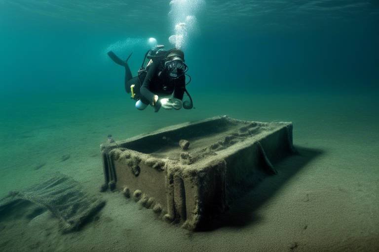
Underwater Archaeology Technologies
Underwater archaeology technologies play a crucial role in exploring and documenting submerged historical sites and shipwrecks that hold valuable insights into the past. Specialized tools and equipment are utilized in this field to navigate the challenges of working underwater and uncovering artifacts hidden beneath the sea.
One of the key technologies used in underwater archaeology is remotely operated vehicles (ROVs). These unmanned submersibles are equipped with cameras, lights, and manipulator arms, allowing researchers to visually inspect and collect data from underwater sites without the need for direct human intervention. ROVs are essential for conducting detailed surveys and excavations in deep and remote underwater locations.
Sonar systems are another vital tool in underwater archaeology. By emitting sound waves and analyzing the echoes that bounce back, sonar technology can create detailed maps of the seafloor and detect submerged structures and objects. This enables archaeologists to identify potential sites of interest and plan targeted investigations with precision.
Underwater archaeological expeditions also rely on advanced imaging techniques, such as side-scan sonar and multi-beam echo sounders, to capture high-resolution images of underwater landscapes. These technologies help researchers visualize and document underwater sites in intricate detail, providing valuable data for analysis and interpretation.
Frequently Asked Questions
- What is Lidar Technology and how is it used in archaeology?
Lidar Technology is a cutting-edge method that employs airborne laser scanning to create detailed 3D maps of archaeological sites. This technology enables researchers to uncover hidden structures and features without causing any disturbance to the environment.
- How does Ground-Penetrating Radar (GPR) contribute to archaeological surveys?
GPR technology plays a crucial role in detecting subsurface features and anomalies, such as buried structures and artifacts. By sending radar pulses into the ground and analyzing the reflected signals, researchers can unveil hidden treasures without excavation.
- What are the benefits of using drones for archaeological surveys?
Drone surveys provide researchers with high-resolution aerial images of archaeological sites, facilitating the creation of detailed maps and data for analysis and documentation. Drones offer a non-invasive and efficient way to study historical sites from above.
- How does Remote Sensing aid in archaeological research?
Remote Sensing utilizes satellite imagery and aerial photography to identify and monitor archaeological sites. This technology allows researchers to study vast areas and track changes in landscapes over time, providing valuable insights into ancient civilizations.
- What is the significance of Geophysical Surveying in archaeology?
Geophysical Surveying involves the application of various techniques like magnetometry and resistivity surveys to map subsurface features and anomalies. These methods help in the non-invasive exploration of archaeological sites, uncovering hidden historical secrets.
- How are Virtual Reality (VR) Reconstructions used in archaeology?
Virtual Reality Reconstructions enable the creation of immersive digital replicas of archaeological sites and artifacts. Researchers and the public can explore and interact with historical environments in a virtual space, enhancing the understanding of ancient civilizations.
- What role does Digital Data Analysis play in archaeological studies?
Digital Data Analysis involves the use of advanced software and algorithms to process large datasets collected from archaeological surveys. This process helps researchers extract meaningful insights and patterns from the information, contributing to a deeper understanding of the past.
- How do Underwater Archaeology Technologies assist in exploring submerged sites?
Underwater Archaeology Technologies, such as remotely operated vehicles (ROVs) and sonar systems, are vital for investigating and documenting underwater archaeological sites and shipwrecks. These specialized tools provide researchers with the means to explore submerged history.